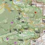
Hiking Trail Finder isn’t just another app; it’s your passport to unlocking countless adventures. Imagine effortlessly discovering hidden gems, meticulously planned routes, and breathtaking vistas – all at your fingertips. This comprehensive guide dives deep into the creation of a revolutionary hiking trail finder application, exploring everything from user interface design and data integration to advanced search algorithms and intuitive navigation.
We’ll uncover the secrets to building a platform that not only meets but exceeds the expectations of every hiker, from seasoned explorers to families seeking a weekend escape. Get ready to transform the way people experience the outdoors.
We’ll dissect the crucial aspects of building a successful hiking app, covering user needs, data sourcing, map integration, trail information presentation, and powerful search functionality. We’ll explore innovative features that set your app apart from the competition and delve into the technical intricacies of ensuring accuracy, reliability, and a seamless user experience. This isn’t just about creating an app; it’s about crafting a tool that empowers people to connect with nature on a deeper level.
Hiking Trail Finder

Building a successful hiking trail finder application requires a deep understanding of user needs and a commitment to intuitive design. This application needs to go beyond simply listing trails; it must become an indispensable tool for hikers of all levels, providing a seamless and enriching experience from planning to post-hike reflection. This necessitates a user-centric approach, prioritizing ease of use and functionality above all else.
User Interface Design
The user interface should prioritize simplicity and clarity. Imagine a clean, modern design with a large, interactive map at its core. Users should be able to easily zoom in and out, pan across regions, and filter trails based on various criteria. Prominent search and filter options should be readily available, perhaps with a dropdown menu offering choices for distance, difficulty, elevation gain, and trail type (e.g., loop, out-and-back).
Clear visual cues, such as color-coded difficulty levels and trail markers on the map, should guide users quickly. The overall aesthetic should be visually appealing, encouraging exploration and engagement. Think of the clean lines and intuitive design of Google Maps, but tailored specifically to hiking trails. Detailed trail information, including photos and user reviews, should be easily accessible with a single click.
Essential Features, Hiking Trail Finder
A successful hiking trail finder application requires a robust set of features. Prioritizing user experience means focusing on features that directly address hiker needs. This includes comprehensive trail information (distance, elevation gain, difficulty level, trail type, points of interest), high-quality maps (offline access is crucial), user reviews and ratings, the ability to save favorite trails, and integration with GPS for navigation.
Further features could include safety features like emergency contact information and trail alerts (for closures or hazards), and the ability to share hiking plans with friends or family. Imagine the functionality of AllTrails, but with enhanced personalization and a smoother, faster interface.
User Personas
Different user groups require tailored features and experiences. Consider these personas:
- The Beginner Hiker (Sarah): Sarah is a 28-year-old office worker looking for easy, well-maintained trails near her city. She prioritizes safety and clear directions. She values detailed trail descriptions, high-quality photos, and user reviews focusing on accessibility.
- The Experienced Hiker (Mark): Mark is a 45-year-old seasoned hiker seeking challenging trails with stunning views. He prioritizes accurate elevation data, detailed maps (including offline capabilities), and the ability to filter trails based on technical difficulty. He values features like elevation profiles and GPS tracking.
- The Family Hiker (The Smiths): The Smiths are a family of four with two young children. They are looking for short, relatively flat trails with amenities like picnic areas and restrooms. They prioritize safety, accessibility, and features that cater to children, such as points of interest that would engage younger hikers.
Innovative Features
To stand out, a hiking trail finder needs innovative features. One example is incorporating augmented reality (AR) overlays onto the live map, showing real-time trail conditions and highlighting points of interest as the user walks. Another is integrating with social media platforms to allow users to easily share their hiking experiences and connect with other hikers. Finally, personalized recommendations based on past hikes and user preferences could significantly enhance user engagement.
Imagine a system that suggests trails based on your preferred difficulty, distance, and type of scenery, learning your preferences over time. This level of personalization would create a truly unique and engaging experience, setting the application apart from its competitors.
Data Sources and Integration

Building a robust hiking trail finder requires access to a diverse and reliable stream of data. The accuracy and comprehensiveness of your application hinges on the quality and integration of this information. We’ll explore the key data sources, the intricacies of combining them, and the crucial role of data validation in ensuring a user-friendly and dependable experience.Data sources for a hiking trail finder are multifaceted.
Government agencies, like the National Park Service in the US or equivalent organizations globally, often maintain detailed trail maps and descriptions. These sources offer authoritative information, but data formats and accessibility can vary widely. Commercial mapping services, such as OpenStreetMap and Google Maps, provide extensive geographical data, including trail networks. However, the detail and accuracy of trail information can be inconsistent, requiring careful verification.
Finally, user-submitted data offers a powerful way to supplement official sources, providing real-time updates and information on lesser-known trails. However, this requires a robust moderation system to ensure data quality.
Data Source Integration Strategies
Integrating data from multiple sources requires a well-defined strategy. Consider a system where government data forms the foundational layer, providing a comprehensive base map. This can be supplemented by commercial mapping services, which may offer better detail in certain areas or updated information on trail closures. User-submitted data can then enrich this foundation, adding details like trail conditions, recent changes, or user reviews.
This multi-layered approach requires careful data transformation to ensure compatibility and consistency. Different data sources may use varying formats (e.g., shapefiles, KML, GeoJSON), coordinate systems, and attribute descriptions, requiring significant data cleaning and standardization. This often involves custom scripting and the use of GIS software. For example, a system might employ Python libraries like GDAL/OGR to handle different geospatial data formats and project them into a consistent coordinate system (e.g., WGS 84).
Data Validation and Accuracy
Ensuring data accuracy is paramount. A multi-pronged approach is necessary. Automated validation checks can identify inconsistencies or errors, such as overlapping trails or geographical anomalies. For instance, a system could flag trails that extend into bodies of water or exceed implausible lengths. Manual review by trained moderators is also crucial, especially for user-submitted data.
This human-in-the-loop process is vital for identifying subtle errors or inconsistencies that automated checks might miss. Regular data updates from official sources and user feedback mechanisms further enhance accuracy. Consider incorporating a system where users can flag inaccuracies or provide corrections, which are then reviewed before being integrated into the database. Regular audits and comparisons with authoritative sources help maintain the long-term accuracy of the trail data.
User-Submitted Data Management
A system for managing user-submitted data needs to balance community contribution with data quality. A tiered moderation system could be implemented, starting with automated checks for obvious errors (e.g., incomplete data, invalid coordinates). Data then undergoes review by volunteer moderators, who verify the information against existing data and identify potentially problematic submissions. Finally, a team of expert moderators might handle complex or contentious issues.
Clear guidelines for data submission, along with a rating system for user contributions, encourage high-quality input. A points-based system rewarding accurate contributions and penalizing inaccurate ones could incentivize users to submit reliable information. This system would also include a transparent process for handling disputes or disagreements over trail data, potentially involving a community voting mechanism or appeals process.
The goal is to create a positive feedback loop, encouraging community participation while maintaining data integrity.
Building a successful Hiking Trail Finder application requires a meticulous blend of user-centric design, robust data management, and innovative technological integration. From crafting an intuitive interface to implementing advanced search algorithms and ensuring data accuracy, every detail contributes to a compelling user experience. By focusing on the needs of diverse user groups and leveraging cutting-edge mapping and navigation technologies, you can create a platform that not only helps people discover incredible trails but also fosters a deeper appreciation for the natural world.
The journey to creating the ultimate hiking companion begins now. Are you ready to embark?

