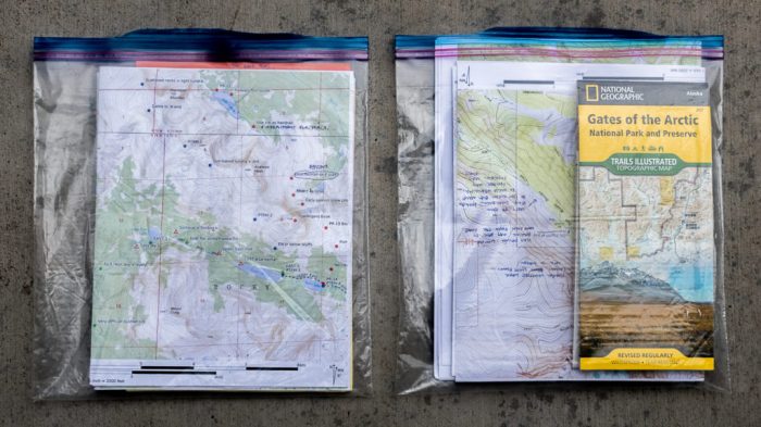
Backpacking Maps are your lifeline in the wilderness. This isn’t just about finding your way; it’s about understanding the terrain, anticipating challenges, and maximizing your adventure. From choosing the right map—paper or digital—to mastering essential map-reading skills, we’ll equip you with the knowledge to confidently navigate any trail. We’ll cover everything from interpreting contour lines and symbols to leveraging technology for enhanced navigation, ensuring you’re prepared for anything the backcountry throws your way.
Get ready to unlock the power of map mastery.
This comprehensive guide dives deep into the world of backpacking maps, covering various types, essential skills, technological integrations, and advanced techniques. Whether you’re a seasoned backpacker or just starting out, you’ll find valuable insights to enhance your outdoor experiences and boost your confidence on the trail. We’ll demystify map reading, equipping you with the skills to plan routes, identify potential hazards, and navigate with precision.
Utilizing Technology with Backpacking Maps

Paper maps remain a crucial backpacking tool, offering a tangible, reliable backup in case of electronic failure. However, integrating technology significantly enhances navigation, safety, and overall trip planning. Smartphones and GPS devices provide real-time location data, detailed trail information, and emergency communication capabilities that traditional maps simply can’t match. This strategic blend of old and new ensures a more informed and safer backpacking experience.
The synergy between paper maps and digital technology is key. Paper maps serve as a fail-safe, offering a constant visual reference even without battery power. GPS devices and apps, conversely, provide precise location tracking, allowing for better route planning and the ability to quickly identify your position, especially crucial in challenging terrain or during unexpected weather changes. This combined approach mitigates the risks associated with relying solely on one method.
Offline Map Application Download and Usage for Backpacking
Downloading offline maps is a critical step for reliable navigation in areas with limited or no cell service. Before your trip, identify the specific region you’ll be backpacking in and use a mapping application that allows for offline map downloads. Most reputable apps provide detailed topographic maps, trail information, and points of interest, all accessible without an internet connection.
Ensure you download maps covering a wider area than your planned route to account for potential detours or unexpected situations. Familiarize yourself with the app’s interface and featuresbefore* you leave for your trip; practice using it in a familiar environment to avoid confusion in the wilderness. Regularly check for updates to ensure you have the most current map data.
GPS Technology Accuracy and Reliability in Remote Areas, Backpacking Maps
The accuracy and reliability of GPS technology vary depending on several factors, including the type of device, satellite signal strength, and environmental conditions. While GPS is generally reliable, dense tree cover, deep canyons, or even severe weather can significantly impact signal reception. Different GPS technologies exist, such as GPS, GLONASS, and Galileo, each with its own constellation of satellites.
Using a device that supports multiple global navigation satellite systems (GNSS) generally improves accuracy and reliability, particularly in challenging environments. Always carry a paper map and compass as a backup; they provide a completely independent navigation method, essential in case of GPS failure. For instance, in a dense forest, a handheld GPS receiver might lose signal intermittently, making a compass and map indispensable for maintaining your bearing.
Essential Smartphone Apps for Backpacking
A well-chosen selection of smartphone apps can dramatically enhance your backpacking experience. Remember to download all apps and necessary maps
before* leaving for areas with limited or no cell service.
Below is a list of essential apps, focusing on their map-related capabilities:
- Gaia GPS: Offers detailed topographic maps, offline map downloads, route planning, and track recording. Its robust offline capabilities make it ideal for remote areas.
- AllTrails: Provides user-generated trail reviews, photos, and maps, making it useful for researching trails and understanding trail conditions. While it’s primarily for trail information, its map features can be helpful for navigation.
- Avenza Maps: Allows you to download and use a wide variety of maps, including custom maps, topographic maps, and even scanned paper maps. This offers flexibility for those who prefer specific map styles.
- Maps.me: A popular choice for offline maps, offering detailed street-level maps, even in remote areas. While not specifically designed for backpacking, it provides a reliable backup map source.
Mastering backpacking maps isn’t just about reaching your destination; it’s about understanding the journey. By combining traditional map skills with modern technology, you’ll transform from a simple hiker into a confident explorer. This guide has provided you with the foundational knowledge and advanced techniques to confidently tackle any backpacking adventure. Remember, preparation is key; a well-planned trip, supported by your map mastery, ensures a safe and unforgettable experience.
So, grab your maps, pack your bags, and explore the world with confidence.

